CityLink Chemnitz – Smart Urban Navigation
CityLink Chemnitz – Smart Urban Navigation
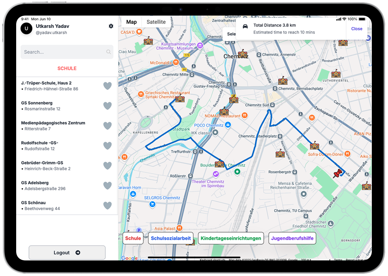
CityLink Chemnitz is an interactive map-based navigation platform that helps residents and visitors quickly locate essential social facilities, such as hospitals, pharmacies, public services, and community centers.
🔹 Key Features
✅ Real-Time Routing & Navigation
By integrating MapBox & Google Maps APIs, CityLink provides live routing, optimized paths, and turn-by-turn navigation for users, ensuring the fastest and most efficient routes.
✅ Smart Search & Filtering
Users can filter facilities based on:
- Facility Type: Hospitals, pharmacies, shelters, etc.
- Proximity & Availability: Shows nearby facilities with open status.
✅ Geospatial Data Integration
CityLink uses real-time geospatial data to dynamically update facility locations, ensuring accurate and up-to-date information.
✅ Optimized Performance with Next.js
- Faster page loading and smooth user interactions.
- Scalable architecture ensures the platform remains responsive even with high traffic.
🛠 Technologies Used
- Frontend: Next.js, TypeScript
- Maps & Geospatial Data: MapBox API, Google Maps API
- Performance Optimization: RES (Resource-Efficient Scheduling)
CityLink Chemnitz enhances urban accessibility by providing residents with a seamless way to locate and navigate critical social services.